
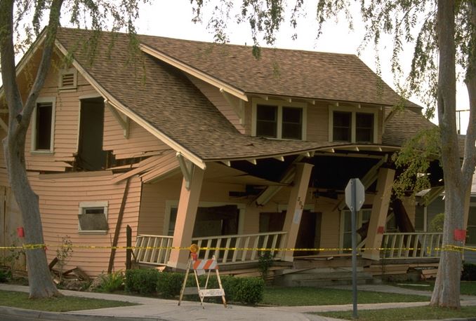
There have been 54 major earthquakes in California since 1900, defined as an earthquake of at least magnitude 6.5, and/or causing loss of life or property damage greater than $200,000, according to the California Geological Survey. The last major earthquake was a magnitude 6.5 and occurred on December 22, 2003 in San Simeon, causing substantial damage in nearby Paso Robles.
With 54 major earthquakes over the past 115+ years, one major earthquake occurs on average every 2.1 years. Therefore, it appears California is well overdue for a major earthquake.
Where will the next big earthquake occur?
Statistically, the next “big one” (of around magnitude 8.0) will occur along the southern end of the San Andreas Fault, according to geologist Pat Abbott of San Diego State University.
Most of California’s populated areas are located in or near an earthquake hazard zone. The exception is California’s Central Valley, encompassing cities like Fresno and Sacramento (property lying east of I-5 north of Delano and south of Redding). Here, you are as safe as you can be (in California) from earthquakes.
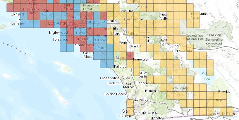
The map above shows a broad picture of earthquake fault zones — the yellow and red boxes — in Southern California (the blue boxes are landslide and liquefaction zones and the red boxes are both earthquake and landslide zones).
There are 105 cities in California that contain earthquake hazard zones (view the list here). However, just because a city is listed doesn’t mean that the entire city is in an earthquake hazard zone. To find out if a specific property is located in an earthquake hazard zone or any other hazard zone, view maps at the property’s local planning department.
Read more here:
http://journal.firsttuesday.us/real-estate-disaster-scenario-part-iii-earthquakes/48307/


Very informative post, thanks!
Begs the real-estate related question: So what about earthquake insurance? Worth it? Super-high deductible so maybe its illusory insurance absent catastrophic damage? No need to buy it since the government will step in anyway? Might as well have it since it really isn’t that expensive — few hundred bucks a year? In 20+ years I never bought it. But I did this year. Mainly because of the loss-of-use payout that isn’t subject to the deductible. I am surprised lenders don’t require it; what’s it to them to make people shell out a few extra bucks? Of course, I really hope I am just wasting my money….
On the map it looks like North County Coastal doesn’t have much concern, and I think they would be pretty strict about actually losing the use – the house would have to be falling down to qualify.
So yes, you’re probably throwing your money away.
Probably so. Seeing the map I understand why the insurance around here is so cheap, inch closer to the danger zone and it probably jumps up considerably. I was focusing more on the rentals as far as loss of use is concerned. Earthquake breaks some pipes and the place floods or some such thing, and the tenant moves out as a result. Lost rent is covered until the place is fixed and new tenant found… Might not work out that way, but for $325 a year, I can at least “feel” covered.
I didn’t think of busted pipes, but it would take a real shaker to break them loose.
But $325 is cheap protection.